

Monthly Soil Moisture (0-10 cm)
- Home
- »
- Search
- »
- Africa
- »
- East Africa
- »
Data Sets
Monthly Period
East Africa
Loading subregion products...
Product Documentation
Soil Moisture
(February 2019)
Background
The Famine Early Warning Systems Network (FEWS NET) Land Data Assimilation System (FLDAS) is a custom instance of the NASA Land Information System (LIS) that has been adapted to work with domains, data streams, and monitoring and forecast requirements associated with food security assessment in data-sparse, developing countries. Adopting LIS allows FEWS NET to leverage existing land surface models and generate ensembles of soil moisture, evapotranspiration (ET), and other variables based on multiple meteorological inputs or land surface models. The goal of the FLDAS activity is to achieve more effective use of limited available hydro-climatic observations, and it has been designed to be adopted for routine use for FEWS NET decision support.
Source Data
The soil moisture distribution products are derived from the FLDAS Noah Land Surface Model L4. The source data are provided by NASA through the GES DISC site in netCDF format. The netCDF file contains a series of land surface parameters simulated from the Noah model within FLDAS.
This simulation was forced by a combination of the Modern Era Retrospective-analysis for Research and Applications Version 2 (MERRA-2) and daily Climate Hazards Center InfraRed Precipitation with Stations (CHIRPS) data that has been downscaled to 6-hourly rainfall data using the NASA Land Data Toolkit.
The simulation was initialized on January 1st 1982 using soil moisture and other state fields from a FLDAS/Noah model climatology for that day of the year.
The data are 0.10-degree resolution and range from January 1982 to the present. The temporal resolution is monthly, and the spatial coverage is global (60S, 180W, 90N, 180E) (Figure 1):

Figure 1. FLDAS spatial coverage source data. Source: GES DISC
Products
The soil moisture products are available for every month of the year, for three regions of Africa (Southern Africa, Western Africa, and Eastern Africa), and for two soil layer depths: 0-10 cm and 10-40 cm. For each soil layer depth, the following derivative products are available:
- Soil depth 0-10 cm (upper layer)
- Soil moisture
- Difference Anomaly
- Percent Anomaly
- Soil depth 10-40 cm
- Soil moisture
- Difference Anomaly
- Percent Anomaly
- Soil depth 0-100 cm (derived product: 0-10cm, 10-40cm, and 40-100cm weighted average)
- Soil moisture
- Difference Anomaly
- Percent Anomaly
Soil moisture – units in m3/m3
Difference Anomaly – units in m3/m3: these anomalies represent a subtraction of the 1982-2011 (30-year) mean soil moisture values for a monthly period from current year values for the same period as:

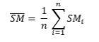
where SManom is the anomaly difference of soil moisture for a certain month, SM is the soil moisture for a certain month, SMis the mean soil moisture for the month, and n is the numbers of years in the climatology average period.
Percent Anomaly – units in % - this anomaly, referred to as percent of normal, uses the 1982-2011 mean to compare the current monthly soil moisture to average conditions. The calculation is as follows
where SManompct is the (anomaly) percentage of soil moisture for a certain month.
Coordinate System Description
Spatial Reference: GCS_WGS_1984
Units: DD (decimal degrees)
Datum: D_WGS_1984
Pixel size: x-direction: 0.1°; y-direction: 0.1°
NoData value: -9999.0
GeoTIF data zip products
- Soil moisture and Difference Anomaly – these products’ values are scaled up (multiplied) by a factor of 10000 to preserve precision and an appropriate colormap is provided.
- Percent Anomaly – these products are rounded to the nearest integer and an appropriate colormap is provided.
References
McNally, A. et al. A land data assimilation system for sub-Saharan Africa food and water security applications. Sci. Data 4:170012 doi: 10.1038/sdata.2017.12 (2017).
Amy McNally NASA/GSFC/HSL (2018), FLDAS Noah Land Surface Model L4 Global Monthly 0.1 x 0.1 degree (MERRA-2 and CHIRPS), Greenbelt, MD, USA, Goddard Earth Sciences Data and Information Services Center (GES DISC), Accessed: Feb 25, 2019, 10.5067/5NHC22T9375G
Rui, Hualan and McNally, Amy, Readme Document for Famine Early Warning Systems Network (FEWS NET) Land Data Assimilation System (FLDAS) Products. Accessed March 1, 2019 at http://hydro1.gesdisc.eosdis.nasa.gov/data/FLDAS/FLDAS_NOAH01_C_SA_M.001/doc/README_FLDAS.pdf.
How to cite figures from USGS
U.S. Geological Survey, 2018, FEWS NET data portal: available online at [https://earlywarning.usgs.gov/fews/product/308]. (Accessed May 14, 2018)
