
ATTENTION!
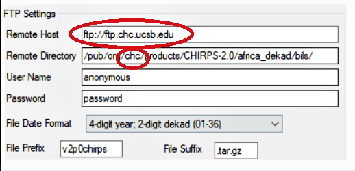
GeoCLIM data download requires ftp address changes.
Click Here
for more details on fto address changes.
GeoCLIM Overview

The GeoCLIM is a spatial analysis tool designed for climatological analysis of historical rainfall and temperature data. The GeoCLIM provides non-scientists with an array of accessible analysis tools for climate-smart agricultural development. These user friendly tools can be used to obtain and analyze climate data, blend station data with satellite data to create more accurate datasets, analyze seasonal trends and/or historical climate data, create visual representations of climate data, create scripts (batch files) to quickly and efficiently analyze similar “batches” of climate data, view and/or edit shapefiles and raster files, and extract statistics from raster datasets to create time series.
GeoCLIM for QGIS
- QGIS3 GeoCLIM Plugin v3.1.0 (41MB)
- QGIS3 GeoCLIM Installation Manual (1.1MB)
- QGIS3 GeoCLIM Release Notes v3.1.0 (199KB)
- QGIS3 GeoCLIM Manual (English) (4.1MB)
- QGIS3 GeoCLIM Manual (Spanish) (4.2MB)
QGIS3 GeoCLIM Data Archives
- CHIRPS_2.0_PENTAD_AFRICA_QGIS3_Plugin (794MB)
- CHIRPS_PPT_GLOBAL_DEKADAL_QGIS3_Plugin (2.6GB)
- CHIRPS_PPT_GLOBAL_MONTHLY_QGIS3_Plugin (1.2GB)
- GDASUSGS_PET_GLOBAL_DEKADAL_QGIS3_Plugin (14MB)
- GHORN_TEMP_AVG_QGIS3_Plugin (80MB)
- GHORN_TEMP_MAX_QGIS3_Plugin (81MB)
- GHORN_TEMP_MIN_QGIS3_Plugin (82MB)
- HOBBINS_ET_DEKADAL_QGIS3_Plugin (18MB)
GeoCLIM for Windows
Important Note: The GeoCLIM v1.2.1 software contains an older version of the manual. To get the latest version, please download it from the manual link below.Windows GeoCLIM Data Archives
- CHIRPS_2.0_PENTAD_AFRICA (1.5GB)
- CHIRPS_NEPAL_MONTH (160MB)
- CHIRPS_PPT_GLOBAL_DEKADAL (2.4GB)
- CHIRPS_PPT_GLOBAL_MONTHLY (1.2GB)
- CHIRP_ethiopia_improved (495MB)
- Cen_Trends_MONTHS (55MB)
- GHORN_TEMP_AVG (86MB)
- GHORN_TEMP_MAX (86MB)
- GHORN_TEMP_MIN (89MB)
- HOBBINS_ET_DEKADAL (17MB)
Windows GeoCLIM Videos
-
Installation of the GeoCLIM
08:58 -

Overview of GeoCLIM
22:09 -
Data types used in GeoCLIM
07:05 -
The tools to set GeoCLIM
06:14 -
The Spatial data viewer in GeoCLIM
20:21 -
Reclassifying rasters in GeoCLIM
10:19 -

Blending stations and raster/grids
21:12 -

Creating archives
15:31 -

Climatological analysis tool – averages, trends
08:46