GeoEngine 5 Web Service
- Home
- »
Geoengine 5 Getting Started
GeoEngine is a software that manages raster inventory on disk, and makes sure those rasters are added as layers to GeoServer.
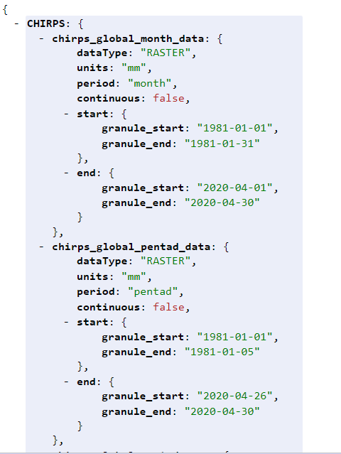
To see what GeoEngine layers are managed in GeoServer, GeoEngine provides a layer config endpoint which provides a list of layers and its related data as JSON.
Available GeoEngine 5 Layers: GeoEngine Layers Config
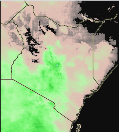
The layer names shown here have the same names in GeoServer. These are wmst layers that are updated every 'period', so here period could be month, day, dekad, etc. Here, to see chirps_global_month_data dataset in the GeoServer layer preview page navigate to GeoServer Layer Preview and select Layer Preview on the sidebar to the left and enter dataset name which is chirps_global_month_data in this case inside search box.
WMST layers have granules, which are rasters for a period in time. To make a wmst request to our GeoServer to get a raster at a point in time, make a request like this: GeoServer WMS Request
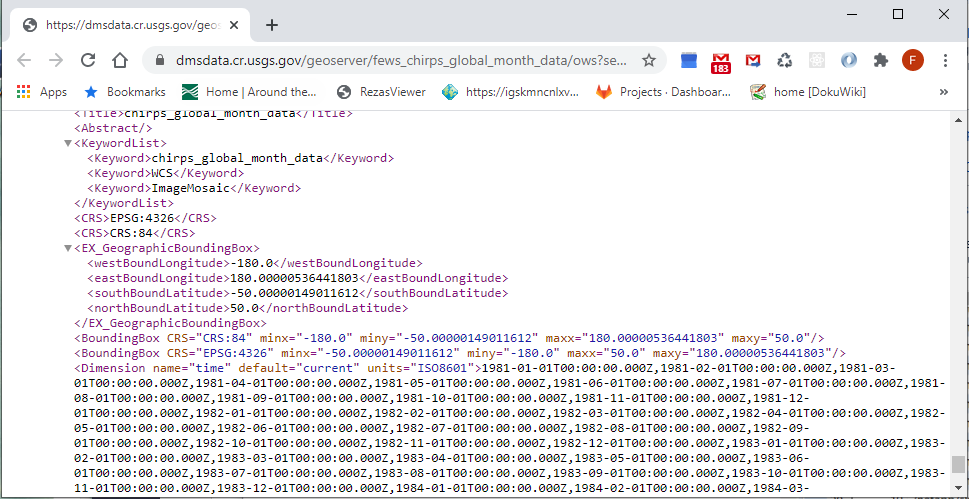
To see all possible wmst granules for a layer, look at its definition in the GeoServer get capabilities url Get Capabilities. The WMST granules that a user can choose from are under the <Dimension> tag that has a name of time.
You can also make a layer request along with other layers that you can see in our GeoServer's layer preview page. Here is an example request with layers fews_chirps_global_pentad_data:chirps_global_pentad_data and fews_g2008_af_0:g2008_af_0: Layer Preview